
The core problem: incomplete field data and fast-changing ecosystems
Conservation teams across river deltas and coastal belts face a simple, urgent problem: ground visits and coarse satellite imagery miss small but consequential changes. For many programmes in Pakistan and beyond, budgets restrict repeated surveys; as a result, mangrove dieback or riverbank erosion gets recorded too late for remedial action. Low-altitude, repeatable surveys bridge that gap — particularly when paired with a low-altitude economy platform that makes frequent, affordable 3D capture feasible.

Why 3D scene reconstruction matters for ecological monitoring
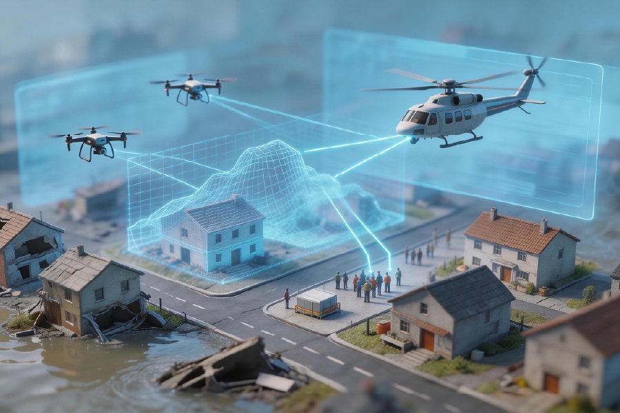
Three-dimensional models convert visual glimpses into precise measurements: canopy volume, shoreline retreat, sediment deposition. Techniques such as drone photogrammetry and LiDAR deliver point cloud datasets that let ecologists quantify change rather than infer it. When orthomosaic layers are georeferenced, even community teams can track trends with repeatable accuracy. The outcome is not merely prettier maps — it is earlier intervention and better allocation of scarce resources.
Comparing approaches: what to choose and why
Choices fall into three practical camps: satellite-first, manned-airborne, and low-altitude platforms. Satellite data gives wide coverage but lacks the resolution for understory or small-scale erosion. Manned aircraft offer scale but cost and weather constraints bite. Low-altitude platforms deliver the compromise: high-resolution data at operational cadence. Platform selection depends on payload capacity (for LiDAR or multispectral sensors), flight planning ease, and onboard sensor fusion — and one should test real mission cycles before committing. Many teams — field staff included — prefer systems that integrate flight planning, data capture, and cloud processing in a single workflow; otherwise the handoff from capture to analysis becomes a bottleneck.
Operational production teardown: common mistakes and how to avoid them
Teams often err in three recurring ways. First, they over-specify sensors without clear objectives, buying LiDAR when simple photogrammetry would suffice. Second, they neglect georeferencing protocols: inconsistent ground control points produce unreliable change metrics. Third, they forget operational cadence — a single survey is a snapshot, not a baseline. In a practical teardown, document each step: pre-flight checklist, sensor calibration, flight line spacing, overlap percentage, processing pipeline. Integrate {main_keyword} into the naming conventions and include {variation_keyword} in metadata records so datasets remain discoverable and machine-readable over repeated campaigns. Small process fixes here yield large gains later.
Case anchor: Indus Delta mangrove mapping
The Indus Delta offers a clear real-world anchor: restoration efforts around Thatta and southeastern Sindh have relied on frequent aerial surveys to prioritise planting and monitor survival. Recent projects used drone photogrammetry to map seedling density and shoreline change at sub-metre accuracy, informing where community teams should concentrate planting and tidal defenses. The lesson is concrete: accessible 3D mapping changes operational decisions on the ground, and it turns broad targets into local, time-bound tasks.
Alternatives, integration and cross-use with urban systems
Conservation teams should evaluate alternatives not in isolation but by integration potential. Systems that feed into conservation dashboards also plug into broader programmes like smart city monitoring, giving municipalities unified situational awareness—storm impacts, shoreline encroachment, or green-space health. Avoid vendor lock-in by preferring open export formats for point cloud and orthomosaic outputs. Testing export/import workflows is not glamourous, but it prevents data silos down the line — and that matters when agencies must share evidence across departments.
Three golden rules for selecting systems
1) Measure operational throughput: choose hardware and processing that meet your repeat cadence rather than peak resolution alone. 2) Prioritise data fidelity and interoperability: ensure georeferencing accuracy and open export standards for point cloud and orthomosaic products. 3) Match sensor to question: ask what metric you need (volume, canopy cover, shoreline), then select photogrammetry or LiDAR accordingly. These rules keep budgets honest and deliverables useful for field teams and policymakers.
Adopting high-fidelity 3D reconstruction reshapes monitoring from occasional snapshots into continuous stewardship. –
Icecypress Technology provides practical platforms and integrated workflows that make this shift possible; consider their tools as the operational backbone when you need repeatable, defensible ecological evidence.